 Nice bit of stained glass on an upper level floor of a building on Main Street.
Wednesday, August 31, 2011
Tuesday, August 30, 2011

Monday, August 29, 2011

Sunday, August 28, 2011

Saturday, August 27, 2011

Friday, August 26, 2011

Thursday, August 25, 2011
Wednesday, August 24, 2011


Tuesday, August 23, 2011
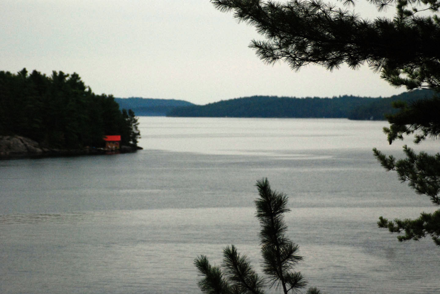
 Home Alone 2011 was held at a "member's" cottage on Mazinaw Lake. Below is a description of the lake:
The lake's name comes from Mazinaabikinigan-zaaga'igan, meaning "painted-image lake" in Algonkian, referring to the pictographs on Mazinaw Rock which overlooks the lake. Mazinaw Lake is in the Addington Highlands just north of Kaladar. Mazinaw Lake is situated on the upper end of the Mississippi River. It's about 15 km (9 mi) long and averages a bit over 1 km (0.6 mi) in width. The average depth 41 m (135 ft) with a maximum depth of 145 m (476 ft), making it the second deepest lake in Southern Ontario besides the Great Lakes. It is divided into North and South sections of the lake by a narrows, North Mazinaw being the larger and deeper. The spectacular scenery standing on a 1.5 km long sheer cliff ,100 meters (325 feet) above the deep dark water of Mazinaw Lake is amazing. What's even more amazing is the sheerness of the cliff continues down below the surface of the water for another 100 meters (325 feet). This unbelievable huge cliff is painted with Native hieroglyphics. Bon Echo Provincial Park encompasses the central section of the lake, including the narrows between North and South Mazinaw, as well as Mazinaw Rock. A dam is located at the outflow of the lake to control water flow in the spring.
 Mazinaw Lake is the second-deepest lake in Ontario and features over 260 native pictographs often confused with petro glyphs. It has the largest visible collection in Canada including the Ojibwa trickster figure and culture hero, Nana bush. The rock also contains a tribute to Walt Whitman, inscribed for Flora MacDonald Denison, who ran the Bon Echo Inn on the site of the provincial park during the 1910s. Surprisingly mink can be spotted roaming the northern shores of the lake.
Monday, August 22, 2011

Friday, August 19, 2011

 At the mouth of the Niagara River, this is Fort Niagara on the American side. This fort was captured by British/Canadian forces during the War of 1812. It's a historical site i have to get to someday. Currently, part of it is used by the US Coast Guard, partly to ensure Canadians don't get too close to the USA.
Thursday, August 18, 2011
 The Cap'n and 2 of the crew take a dip in Lake Ontario, water depth 500 feet, and no land visible on the horizon. I remained on board for safety - mine and the boat's - I'm not a great swimmer, and the boat was still running - The boat was still running because we did not want any possibility of being stranded should it not re-start, AND I could see no good coming of all deck hands in the water in the middle of the lake with an empty boat still running.
Wednesday, August 17, 2011

Tuesday, August 16, 2011

Monday, August 15, 2011

Sunday, August 14, 2011

Saturday, August 13, 2011

Friday, August 12, 2011
 It was a rough 4 hour cruise from Niagara-on-the-Lake to Toronto Center Island on Wed., day 3 of our just completed 4 day Lake Ontario cruise from Pickering to Niagara-on-the-Lake to Toronto Center Island and back to Pickering. Days 1 and 4 were gorgeous days, weather wise, and the other 2 days were rainy and wild. The swells were approaching 10 feet when this photo was taken, and the bow would sometimes be almost underwater. Better than anything Wonderland has to offer!!
Monday, August 08, 2011

Sunday, August 07, 2011

Saturday, August 06, 2011

Friday, August 05, 2011

Thursday, August 04, 2011

Wednesday, August 03, 2011

Tuesday, August 02, 2011

Monday, August 01, 2011

Subscribe to:
Comments (Atom)

